No walking this weekend, as my Mother came down for a few days! I also needed to order some new shoes in as my current walking trainers have worn out.
This brings me to the hiking boots versus robust trainers discussion. I've never been a fan of hiking boots. They seem to hate my feet for some reason! I chafe, blister, ache after wearing them, even when broken in. Hence my reluctance to buy any more. My favourite pair of walking trainers was a pair of Reebok Zigtech sportswear. Utterly beautiful fit, no feetache, and they lasted me a couple of thousand miles!
But I am well aware of their limitations, being totally unsuitable for boggy land, such as when I plan to do the Fort William to Cape Wrath trail route. So, will I have to bite my cheek and get some hiking boots back on my feet? I also will have to somehow overcome my dislike of camping...
Til next week!
Sunday, 23 June 2013
Friday, 14 June 2013
Section 5 of the North Downs Way: Cuxton to Otford
A cloudy start to the day meant a brisk start from Cuxton Station and round the hills over Halling. There are a lot of woods walks in this section, so pardon me if you think I haven't taken too many pictures, but there's only so many photographs you can take of a tree before it gets deadly dull!
I met a Springer Spaniel on the way past Halling, who reminded me of a friend's dog! Right down to the bandana!
You'll forget the sun in his jealous sky
As we walk in fields of gold..."
Better stop singing! (I'm tone-deaf too, and can't sing a note!) Next target is Kemsing, where I've worked before with Dad. A long time ago! We pass another waymarker for the North Downs Way. Oh! Seems I've gone past the halfway mark! Long way to go yet though... We see Kemsing from the top of the escarpment It's a fantastic view from up above!
The end of the section is nigh and I make brisk work of it. When I arrive in Otford, I decide to go straight into the station and not explore. That can wait for another day, I enjoyed the walking today, apart from all the rubble on the ground. There were a lot of flint and chalk pebbles and rock, which makes the path difficult to negotiate at times, as well as where the rain has washed a channel through. But then, it wouldn't be trail walking if it wasn't difficult!
I met a Springer Spaniel on the way past Halling, who reminded me of a friend's dog! Right down to the bandana!
 |
| Views of the Medway from Upper Halling |
 |
| Helluva slope! |
 |
| Danny? Or Robbie? ;o) |
 |
| Lots of trees! |
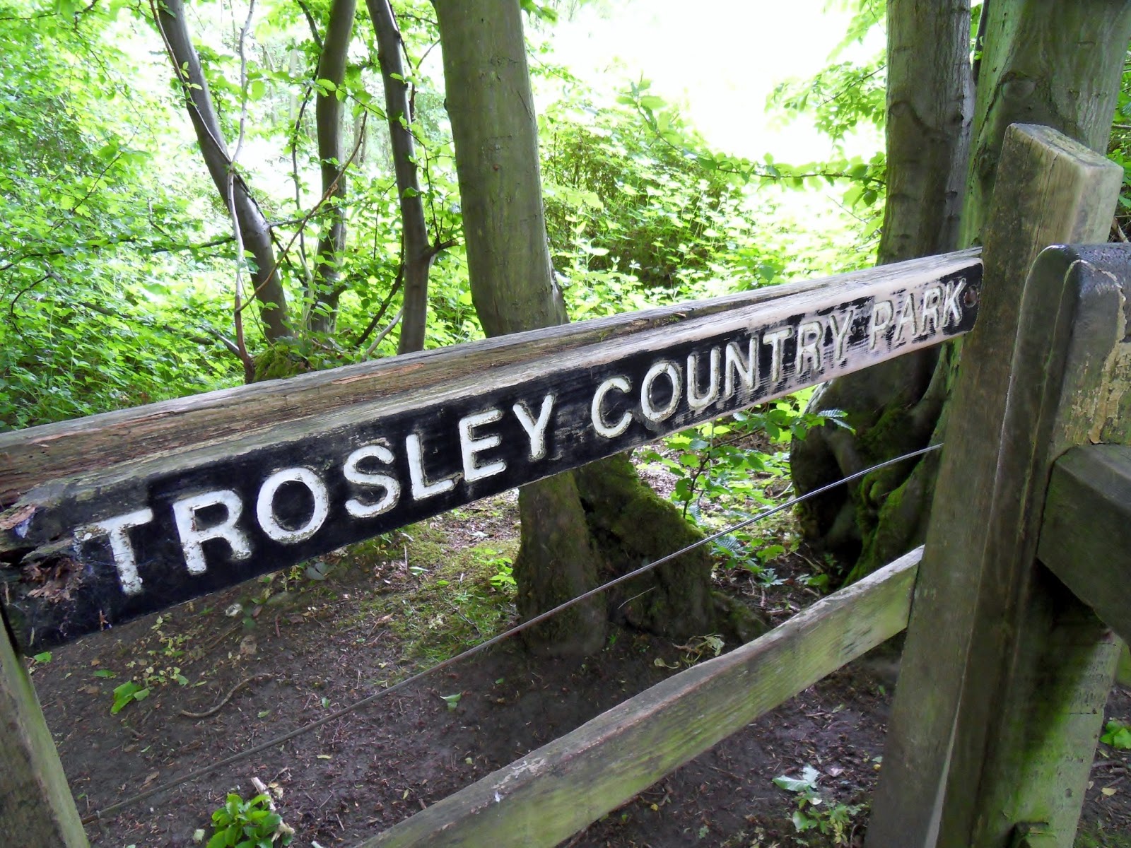
It's an uneventful walk through Rochester Forest, et al, until we get to a very steep, long climb up to Trosley Country Park, which is inbetween Vigo and Trottiscliffe (full marks to anyone who can pronounce this place name - WITHOUT looking it up on Google!) Trosley Country Park is fabulous, if a little artificially created. But then again, what woods in this country aren't artificially created these days?
 |
| The steep climb to Trosley Country Park |
 |
| Love these little waymarkers |
 |
| An alien bursting from the ground! |
 |
| Views from Trosley |
I leave Trosley Country Park and head on down to Wrotham (Another point if you can pronounce this placename too! Wrotham is a cute little village with a nice looking church and I take a few minutes exploring before heading back round onto the Pilgrims Way. Most of the North Downs Way follows or is near the supposed track of the Pilgrims Way from Winchester to Canterbury. Hence why the road names when I'm on tarmac is the Pilgrims Way or Road!
 |
| The road to Wrotham |
 |
| Common Blue Butterfly |
 |
| St George's Church, Wrotham |
 |
| I started singing Sting's "Fields of Gold" here... :oS |
"You'll remember me when the west wind moves
Upon the fields of barleyYou'll forget the sun in his jealous sky
As we walk in fields of gold..."
Better stop singing! (I'm tone-deaf too, and can't sing a note!) Next target is Kemsing, where I've worked before with Dad. A long time ago! We pass another waymarker for the North Downs Way. Oh! Seems I've gone past the halfway mark! Long way to go yet though... We see Kemsing from the top of the escarpment It's a fantastic view from up above!
 |
| NDW Waymarker |
 |
| Stile onto a buttercup meadow |
 |
| Thousands of buttercups! |
 |
| 'Orses |
 |
| Kemsing Memorial |
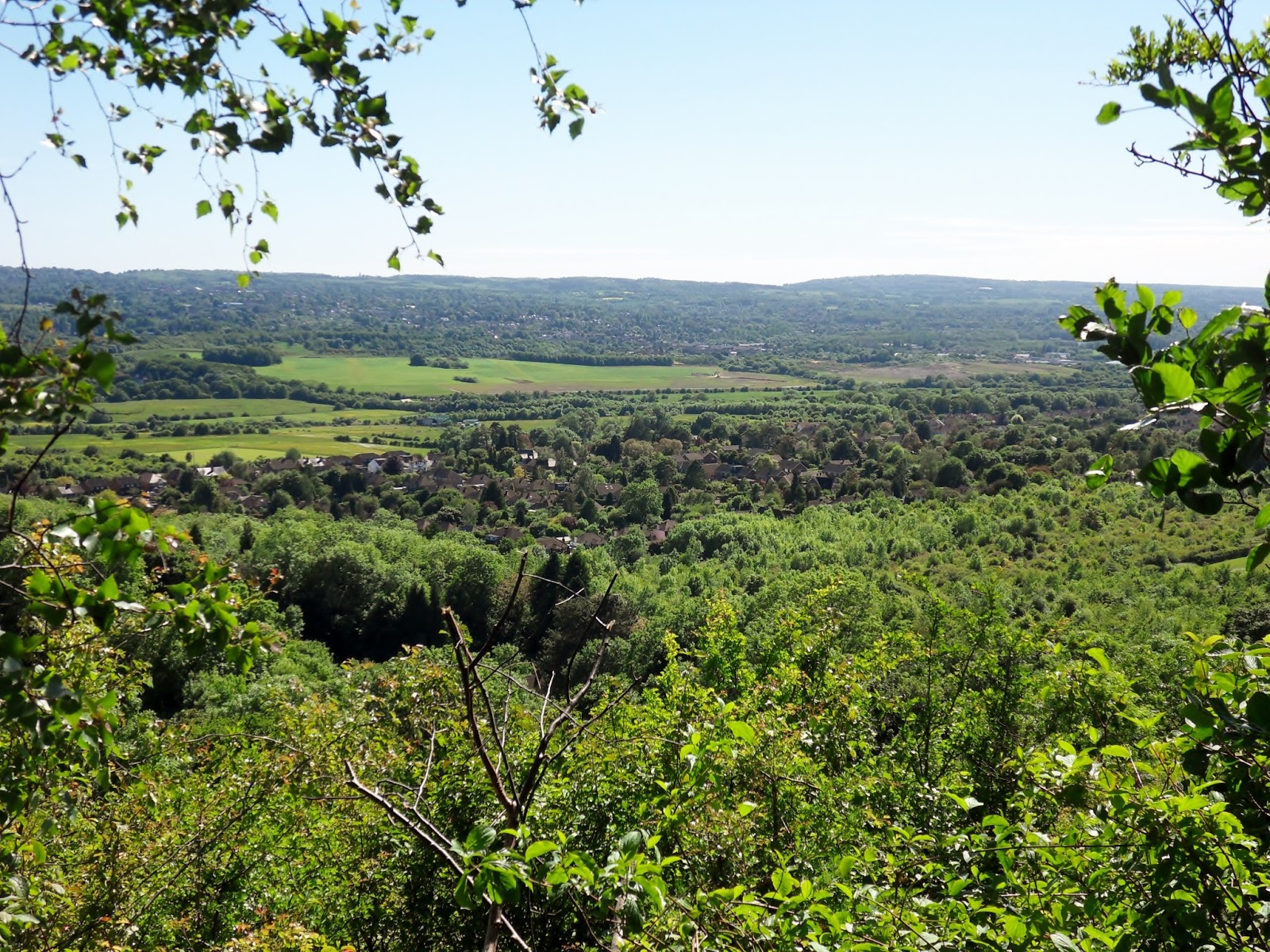 |
| Kemsing |
The end of the section is nigh and I make brisk work of it. When I arrive in Otford, I decide to go straight into the station and not explore. That can wait for another day, I enjoyed the walking today, apart from all the rubble on the ground. There were a lot of flint and chalk pebbles and rock, which makes the path difficult to negotiate at times, as well as where the rain has washed a channel through. But then, it wouldn't be trail walking if it wasn't difficult!
 |
| Beautiful |
 |
| The trail down to Otford |
 |
| Planets!? |
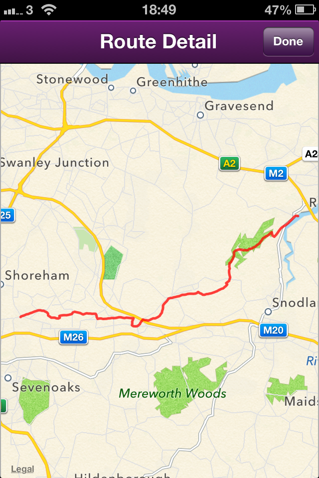 |
| Cuxton to Otford |
Tuesday, 11 June 2013
Finding the right routes
I was talking to a friend of mine about this challenge the other day. It was a conversation about the route I was planning to take after I've completed the North Downs Way. But the friend asked me, if you're going South East to North West, why are you planning to go further south by going to Winchester and Salisbury, before turning northwards to Bath? Is that not wasted energy, time, money?
So this got me thinking. (Yes, there was smoke...) Should I be a completist and endeavour to complete full National Trails before moving onto the next via connecting paths/ways/trails? Or should I concentrate more on getting further north? I've done some research and this is what I could possibly do if I'm not being completist:
I'd have to come off the North Downs Way at Westhumble and follow the Thames Down Link to Kingston Upon Thames (my birthplace) and get onto the Thames Path. At Banbury, you can link to the Cotswolds Way via the Cross Cotswolds Way, which would take me to Bath, and thus the Cotswolds Way to Chipping Campden.
From Chipping Campden to Offa's Dyke Way at Sedbury is a bit of a problem, but I'll overcome that as and when I get there! From Offa's Dyke, I can join the Maelor Way at Chirk and walk over to Grindley Brook, thus connecting with Whitchurch and The Sandstone Trail to Frodsham. That's about as far as I've got so far. The Pennine Way will be another adventure altogether, as will the Coast to Coast Walk.
Anybody out there with any ideas? The main thing is each trail, walk, link has to connect so that it is a continuous walk. :o)
Saturday, 8 June 2013
Section 4 of the North Downs Way: Hollingbourne to Cuxton
Another day, another walk. This time from Hollingbourne to Cuxton. The day was bright, not too warm and a beautiful stiff breeze that lasted all day meant that it was a nice trip. One side note I need to mention. This walk is shown in the guide book at being 17-18 miles. However, I will always include the trip from the railway station to the trail. This meant that before I'd even started on the North Downs Way, I'd already done a mile from Hollingbourne station!
When I finally get back on the trail, I'm immediately met by a long slope, which gets me back on the ridge. I encounter some long horned cattle, peering at me through the trees! Not wanting to be gored, I pushed on quickly. The woods were slippery and wet, and I nearly lost my footing a few times! Especially on the numerous steps up and down! What a way to absolutely knacker someone out!
The guidebook tells me there's a little detour up to Thurnham Castle. With 102 steps! Ugh. But up I go, to tick yet another Kentish castle off my list! These ruins commanded impressive views to the south across the Weald of Kent. And impressive they were!
Eventually we reach Detling where I took my lunch break on a little bench, just off the crossing. I still find it amazing that when they split this village in two with the A249 dual carriageway, it took a few deaths,including 8yo Jade and her grandmother before the council even considered building a crossing over.
After a nice rest, I continue onwards. I'm now looking for Kit's Coty House, the remains of a neolithic chambered long barrow on Blue Bell Hill. I encounter another of the NDW trail milestones. Doesn't seem like I've done much!
After Kit's Coty House, I trudge on up Blue Bell Hill, a long slope that eventually takes me up to Blue Bell Hill Picnic Site. And what views! Utterly outstanding! You can also see the remains of one of the county's largest chalk quarries in Burham, now all overgrown and being reclaimed by nature.
After a few minutes rest and glorying in the views, I decide to push on. Next target is the Medway Viaduct. I'm constantly wondering how I'm going to get across! And how windy it must be up there. It's bad enough when you're driving across it with the crosswinds but I tell you this now; it's W I N D Y! Wow! But you're afforded some fantastic views across to Rochester, with its castle and cathedral, along with the boats and salt flats down below.
Finally I reached Cuxton after 20.96miles of walking! The longest trip so far. Next up is from Cuxton to Otford. The problem I have now is the sheer complexity of getting to and from either place on public transport. But that's a dilemma for another day...
 |
| Walking back to the trail from Hollingbourne Station |
 |
| Hollingbourne from above |
 |
| Met some cows! |
 |
| The trail was very overgrown at times. |
 |
| Any horticulturists out there who can tell me what this is? |
 |
| If you go down to the woods today... |
 |
| Remnants |
 |
| Orchid? |
 |
| Views from Thurnham |
 |
| Thought I'd make a little side trip |
 |
| Thurnham Castle |
 |
| Too many of these today, both up and down! |
 |
| Jade's Crossing |
After a nice rest, I continue onwards. I'm now looking for Kit's Coty House, the remains of a neolithic chambered long barrow on Blue Bell Hill. I encounter another of the NDW trail milestones. Doesn't seem like I've done much!
 |
| Stone stile |
 |
| North Downs Way milestone number 3 |
 |
| Eurostar track |
 |
| Light at the end of a tunnel, under the A229 |
 |
| Kit's Coty House |
After Kit's Coty House, I trudge on up Blue Bell Hill, a long slope that eventually takes me up to Blue Bell Hill Picnic Site. And what views! Utterly outstanding! You can also see the remains of one of the county's largest chalk quarries in Burham, now all overgrown and being reclaimed by nature.
 |
| View from Blue Bell Hill |
 |
| Part of the Burham Chalk Pits Complex |
After a few minutes rest and glorying in the views, I decide to push on. Next target is the Medway Viaduct. I'm constantly wondering how I'm going to get across! And how windy it must be up there. It's bad enough when you're driving across it with the crosswinds but I tell you this now; it's W I N D Y! Wow! But you're afforded some fantastic views across to Rochester, with its castle and cathedral, along with the boats and salt flats down below.
 |
| First view of the Medway Towns |
 |
| Spotting the Medway from Wouldham |
 |
| The Medway Viaducts in the distance |
 |
| Under the Viaducts! |
 |
| Rochester Castle and Cathedral from the bridge |
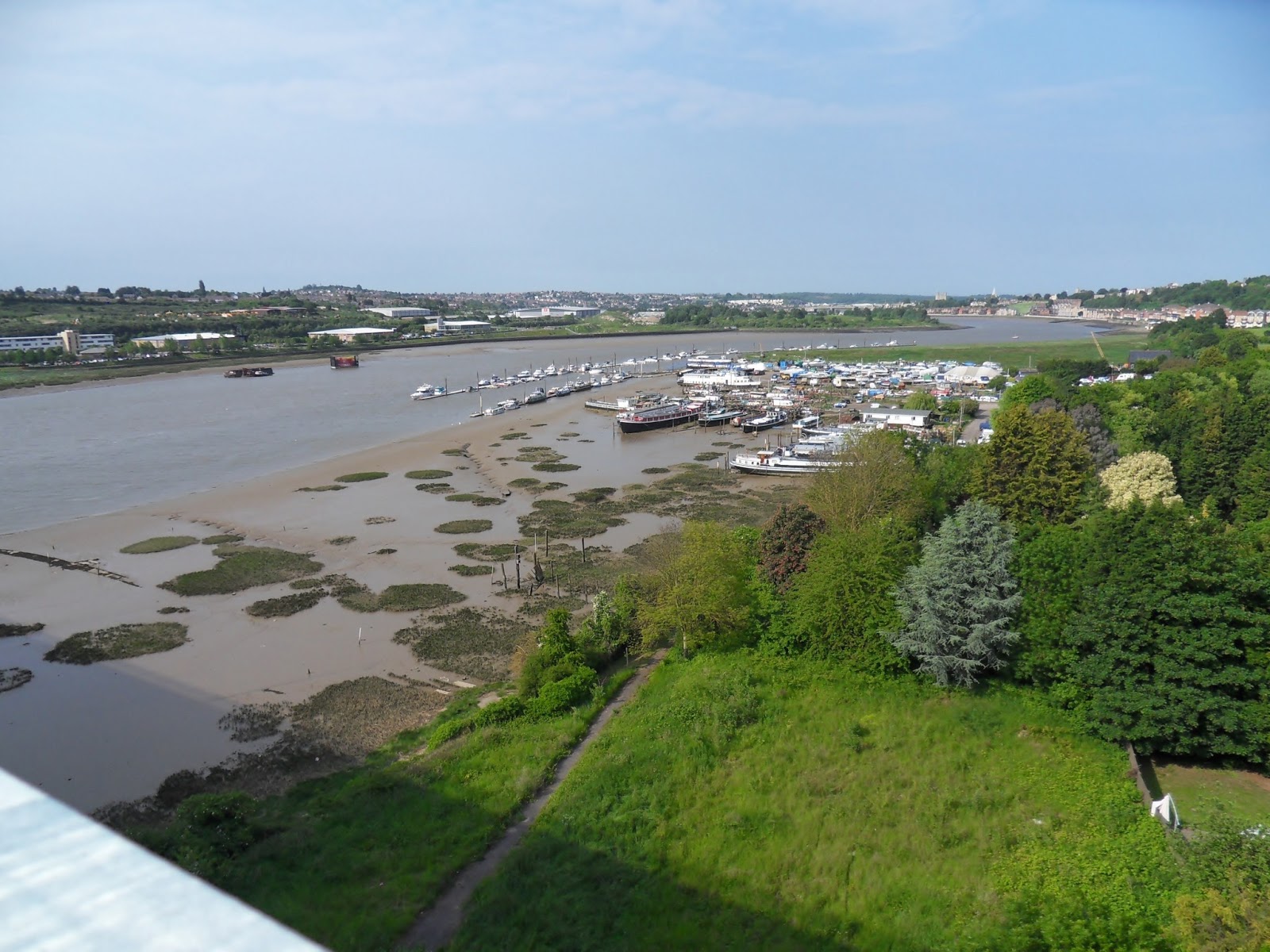 |
| Boats |
 |
| Looking across the bridge |
 |
| Views from Cuxton |
 |
| End of the trail... |
Subscribe to:
Comments (Atom)


